Downtown redevelopers are looking at the next City Parks and Recreation Commission meeting May 3 to present ideas for a $14.1 million riverfront redevelopment project, ‘reimagining’ the north side of the Tittabawassee River from M-20 to the Poseyville Bridge.
The Downtown Development Authority approved a measure March 8 that will modernize the site of the former Farmers’ Market next to the Tridge, and most of the sloping land south of Ann Street to the river, and is looking for even more input from residents as it enters the next stage.

![]() Selina Harris is the community affairs director for the City of Midland.
Selina Harris is the community affairs director for the City of Midland.
“This (the May 3 meeting) information is part of the ongoing effort and will seek the approval of Parks and Rec before getting the final blessing from City Council,” says Selina Harris, Midland community affairs director, noting that work began with overview meetings in June 2022 and a public survey in July and August 2022.
The Downtown Development Authority Board identified riverfront redevelopment as the top priority in its
2022 Plan of Work.
Hoping to begin construction in the Spring of 2024, the DDA’s stated goal for the Downtown Midland Riverfront Redevelopment project is “enhance the Tittabawassee River as a natural resource in Downtown Midland to create a public space that promotes leisure, recreational, and tourism opportunities for residents and visitors from all walks of life. This could mean development of new amenities, programming, architecture and art, and more.”
To that end, the plan recommends Gateway riverfront arches to greet visitors at the east and west ends of the waterfront, parking away from the waterfront, more and upgraded watercraft docks will make river traffic more accessible. More riverfront seating, picnicking areas and improved restrooms are planned. The Farmer’s Market circle will become a plaza for vendors with lawn seating on three sides. On the east side, a large event stage with overhead
If recommended for approval by this commission, it will be sent to the Midland City Council for potential adoption later this summer. If adopted by City Council, a topographical survey and funding plan will be necessary before construction can begin.
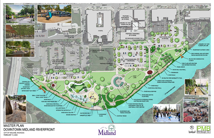
![]() Master Plan Map for Downtown Midland Riverfront
Master Plan Map for Downtown Midland Riverfront
Harris says that the time is right for looking at redevelopment, and according to survey responses, residents are excited about it. The Farmers Market moved from the pavilion in 2020 and the Gerstacker Spray Park west of the structure needs upgrading. In addition, the survey notes that improved access to the river itself, along with improved parking and vendor areas, are at the top of the list.
The reimagined master plan hopefully will determine whether the property primarily remains under city governance or becomes an arm of the Parks and Recreation Commission.
“Right now, it’s a no-man’s land,” Harris says, which is why the DDA is seeking the blessing of numerous governing units as it alters recreational opportunities, public events, parking, public spaces, private amenities, even vendors for the increased opportunities. In addition, the land is in a flood plain, which further complicates development, she notes.
New opportunities, more water play areas including a loop that can be used in both summer as a spray area and winter for ice skating as well as better lighting for longer wintertime use, is included.
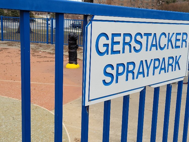
![]() The Gerstacker Spray Park needs upgrading.
The Gerstacker Spray Park needs upgrading.
“We have a unique opportunity to create a special public space that promotes community connections, increases wellbeing, and drives additional economic investment in the downtown area,” the city says in a news release.
The work should complement the rehabbing of the land on the south side of the river, which began last fall on 4D/Oldcastle brick plant , east of Poseyville Road bridge.
According to the City of Midland website, that work will “create a sustainable park, complimented by connections to adjacent wetland restoration sites (Dow Wetland Restoration Site and Towsley Dike Park) and other community amenities.”
The new trail will complete a loop along the river, bookended by the Tridge and the Farmer’s Market to the west, and the new park and and the “Ott Family Foundation” pavilion, the terminal for the “Schuette Family Walkway” across the Tittabawassee on the east, which begins on East Main Street near Dow Diamond and the Founders Garden.
Enjoy this story?
Sign up for free solutions-based reporting in your inbox each week.