A concrete channel installed more than five decades ago near the confluence of the Battle Creek and Kalamazoo rivers has exceeded its life expectancy and needs to be removed, say proponents of efforts to remove it.
The words they use to describe that more than 4,000-foot channel -- “ugly,” “eyesore,” “a detriment” -- symbolize the way they view the concrete embankment constructed as a flood deterrent during the late 1950s and early 1960s by the Army Corps of Engineers.
During the Sept. 7 Battle Creek City Commission meeting, supporters who have been working to rid the river of that concrete channel for more than 12 years, saw what they consider the first signs of a growing groundswell of support for its removal. City commissioners voted unanimously to provide partial funding for a study to be conducted by the Army Corps of Engineers.
“It’s just so obvious to me what a huge gamechanger this would be for the city,” says John MacFarlane, a Battle Creek attorney and founder of the nonprofit
Battle Creek Whitewater Inc., formed in 2014 for the express purpose of getting rid of the concrete channel and restoring that section of the waterway to a more natural state.
MacFarlane says the removal would “transform the entire atmosphere of downtown Battle Creek. All of the things we’re attempting to do with creating a critical mass downtown and drawing people to the city and trying to draw residents and shoppers downtown could now happen. The city is doing wonderful things with the Milton, a climbing wall, and Handmap Brewing. All of these are wonderful things, but we’re not going to hit that critical mass until we do something that’s just two blocks from the central downtown district. That channel is such a blight and such an eyesore.”
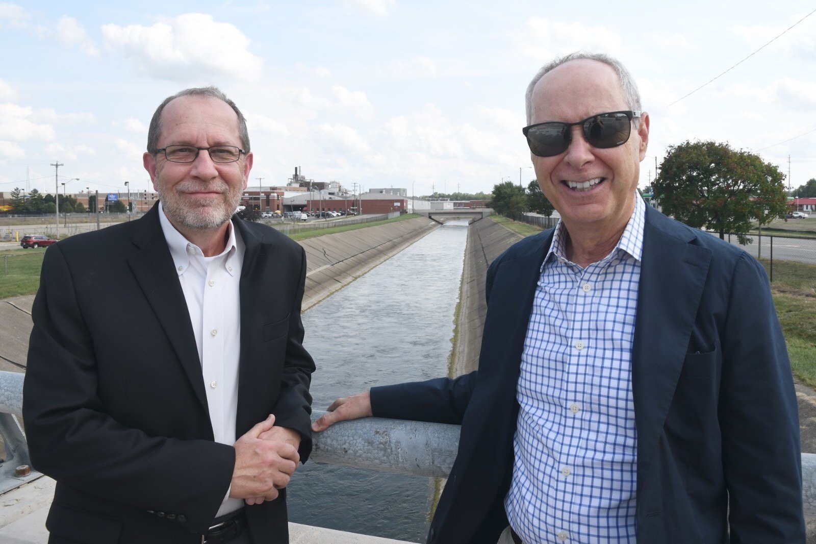
![]() Dave Walters, left, and John Macfarlane are two of the people advocating for a restoration of the Kalamazoo River as it flows south of downtown Battle Creek.
Dave Walters, left, and John Macfarlane are two of the people advocating for a restoration of the Kalamazoo River as it flows south of downtown Battle Creek.The study will cost $500,000, half of these funds will be provided by the Army Corps of Engineers with the remainder coming through a grant the city received from the State of Michigan, says Ted Dearing, Assistant City Manager.
This dollar amount is a drop in the bucket compared to the actual cost of the removal of the channel and redevelopment surrounding the confluence of the two rivers.
Dearing says the modeling has yet to be done, but “based on what we know it took to install and what it may cost to remove the channel, we know we’re talking millions of dollars. The Army Corps of Engineers could make the federal dollars available. Once we have the modeling done we can move into feasibility, design work, and implementation. Obviously, cost will be one of the largest factors. It’s unknown at this point how much it will cost. We know that it’s going to take resources at every level of government.”
The Army Corps of Engineers has a program that provides financial support and assistance to support
river naturalization projects.
Under the authority provided by Section 1135 of the Water Resources Development Act of 1986, the Corps may plan, design, and build modifications to existing Corps projects, or areas degraded by Corps projects, to restore aquatic habitats for fish and wildlife, according to the Army Corps of Engineers website. “Projects conducted in New England under this program have included salt marsh and salt pond restoration, estuary restoration, freshwater wetland restoration, anadromous fish passage, and river restoration. Projects must be in the public interest and cost-effective and are limited to $10 million in Federal cost,” according to information about Section 1135 on the website.
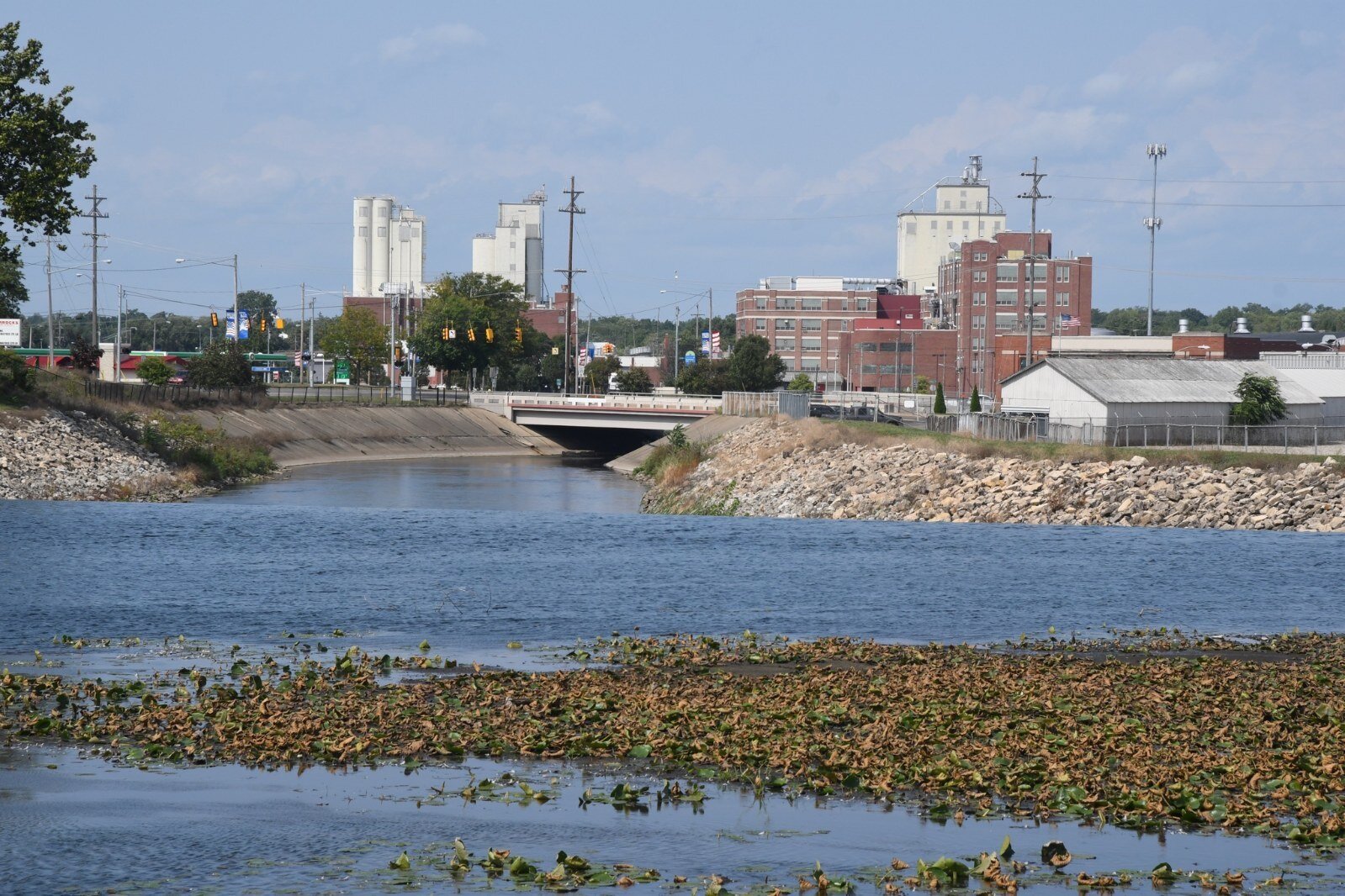
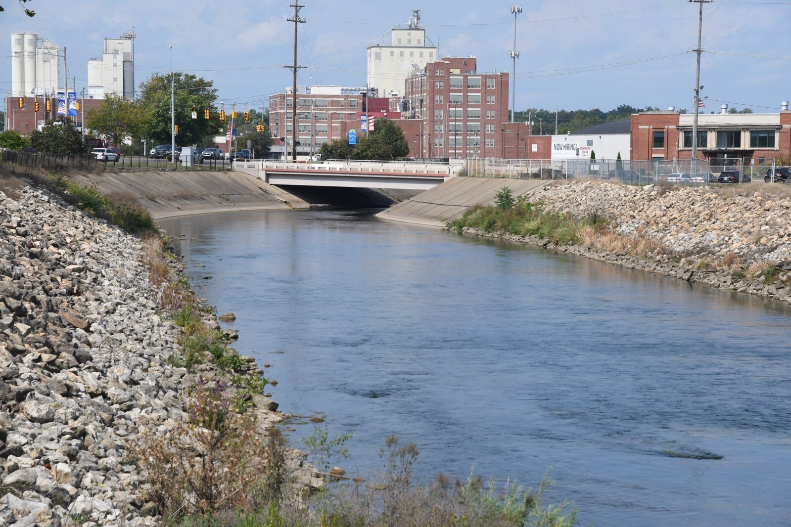
![]() Another view of the Kalamazoo River just above the dam just north of Dickman Road.
Another view of the Kalamazoo River just above the dam just north of Dickman Road.MacFarlane says officials with the Army Corp of Engineers have told his group that if the project is approved, they will contribute $20 million to it which is over and above what is outlined in funding available on the website dedicated to Section 1135. In addition to funding from the Corp, he says money will be available from other sources, including the Michigan National Trust Fund and a fund overseen by
NRDA (the National Resource Damage Assessment) which has money available because of oil spill claims against Enbridge, including those originating locally.
“There are oodles of grant opportunities out there and all sorts of ways we can raise money,” MacFarlane says. “I think money is going to be the least of our worries. Other communities are already getting these dollars to do what we’re talking about.”
The Corp is estimating that they will have the study completed within 24 months. “Obviously, we’re going to push that timeline,” Dearing says. “There are lots of environmental opportunities in returning the river to its natural state. There are lots of recreational opportunities in and around the river. I could see lots of mixed-use developments on or near the river.”
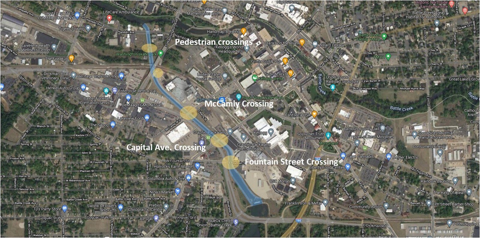
The concrete channel extends from just south of Fountain Street to the confluence with the Battle Creek River near Hamblin Avenue.
MacFarlane says when paddling down the Battle Creek River there is a “little bump” that is fairly easy to get over, but once paddlers reach the confluence of the Battle Creek and Kalamazoo rivers, the latter is inaccessible.
“If I put in at the Battle Creek River anywhere above that confluence, the biggest risk is running aground,” MacFarlane says. “You can pretty much make your way down to the confluence point where the Sullivan Dairy Barn is across from where Farm Bureau used to be. But, as soon as you hit the confluence it turns into the Kalamazoo River. The Battle Creek River ends at that confluence.”
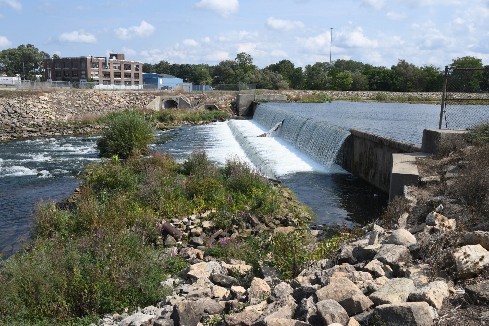
![]() The dam on the Kalamazoo River southeast of downtown Battle Creek just north of Dickman.
The dam on the Kalamazoo River southeast of downtown Battle Creek just north of Dickman.There also is an issue of access. MacFarlane says, “you have to try and slide down and with the concrete walls, there’s no safe way to climb back out.”
With the river flowing at 8,000 cubic feet per second, he says, “You’re taking your life into your own hands if you try to get in at that concrete channel. People have literally died in that river because the flow is so fast.”
MacFarlane says he knows that city and economic development leaders are all in favor of any type of outdoor recreational opportunities that get people out and active, but that in and of itself is not a solution to the problem.
“The issue isn’t a place where people can put kayaks in the water, it’s an issue of urban design,” he says. “We’ve allowed this blight to be inflicted upon us and we need to do what the Army Corps of Engineers did originally and come up with a design to prevent flooding to the same extent or better.”
Changing the channel for a better picture
When asked how long he’s been working on this initiative, MacFarlane says, “I’m embarrassed to tell you that we’ve been working on this for more than 12 years.”
Dearing says there has been a desire on the city’s part for decades to address the channelized portion of the river for a variety of reasons. He said city leaders have long recognized that right now people can't see the Kalamazoo River in its natural state and that creates economic barriers for the southside of the city’s downtown.
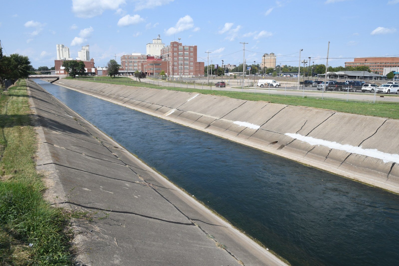
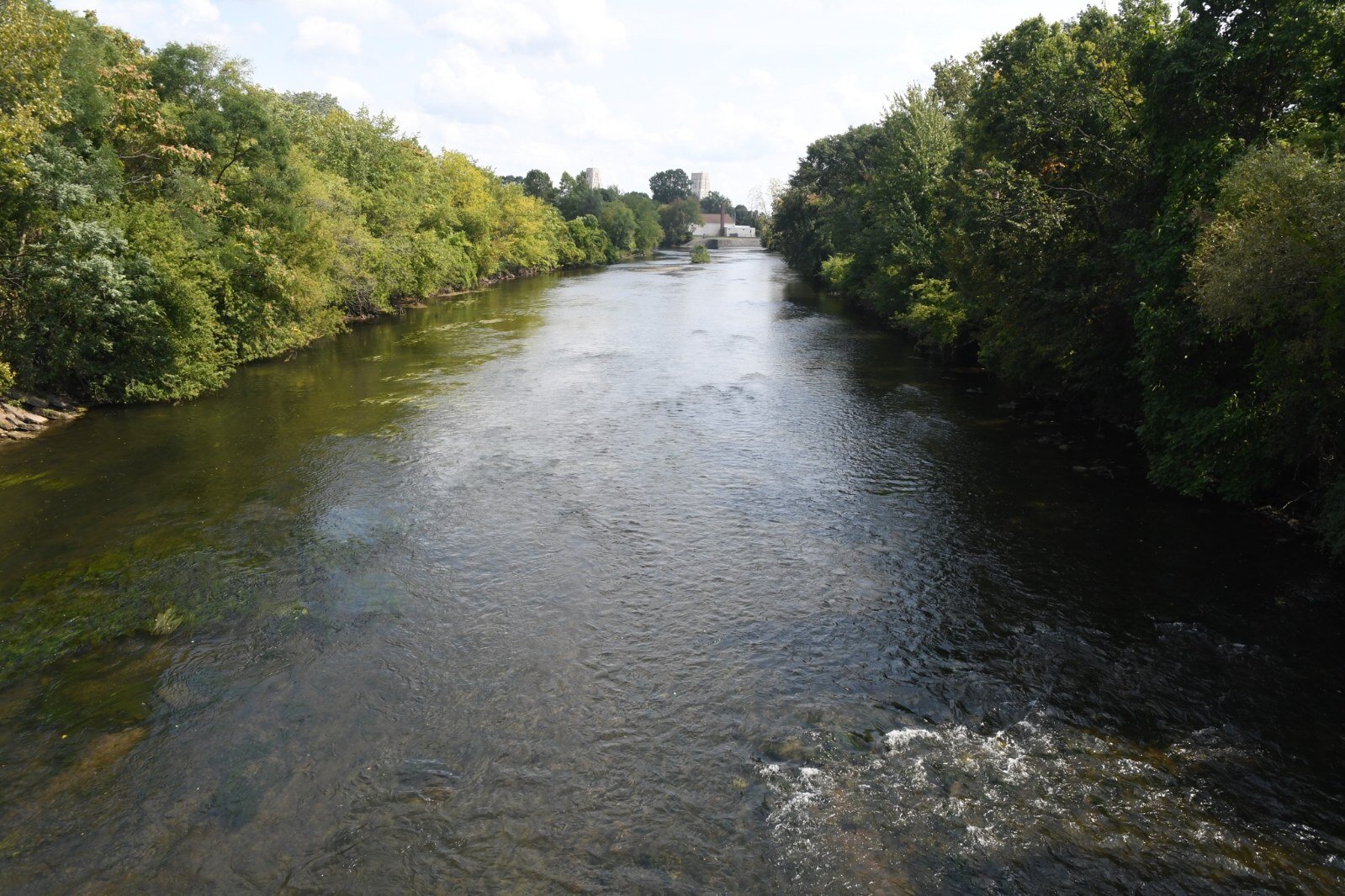
![]() Looking east along the Kalamazoo River from Capital Avenue, south of downtown Battle Creek.
Looking east along the Kalamazoo River from Capital Avenue, south of downtown Battle Creek.“The Army Corps of Engineers installed the channelized portion back in the late ’50s and early ’60s with the assumption that the concrete channel would wear away over time,” Dearing says. “For all practical purposes, it’s nearing the end of its design life. Now really is the time to talk differently going forward. Given the fact that the original channelized portion is nearing the end of its design life, we now have an opportunity to naturalize the river.”
During the many discussions that MacFarlane and other members of his organization have had over the years with residents and community leaders, he says a constant concern has been about the potential for flooding. He says he understands this concern and says any redesign will be done to protect against flooding.
“The river is not going to flood. That’s the condition the Army Corps of Engineers will impose on us as a requirement for the redesign,” MacFarlane says. “Flooding is not going to happen.”
But there is a very real possibility that even with the channel there could be flooding in the future given the anticipated increase in the severity of floods brought about because of climate change and the age of the concrete channel, says Robb Gillespie, a board member with Battle Creek Whitewater and retired Western Michigan University professor of Geology. He agrees that the channel has exceeded its life expectancy and is encouraged by the opportunities to create a better flood control system while returning the river back to its natural state.
“Global warming is only making flood events worse in frequency and magnitude,” Gillespie says. “We need to be thinking ahead about how we handle the floods of the future. They’re going to be bigger and that channel can’t handle it. Nowadays, there are better ways of doing it and we understand rivers a heckuva lot better than we did a half-century ago. (The removal and restoration) can really lead to a number of benefits besides maintaining flood control of the river.”
The city absolutely should be considering what the next stage of flood control is in Battle Creek while also creating something that’s environmentally sustainable, says John Hart, Director of the City of Battle Creek’s Small Business Development Office.
![]() Three bridges would be affected by restoration of the river.
Three bridges would be affected by restoration of the river. “If the Army Corps of Engineers were ever to do flood control again it wouldn’t be designed the way it is now,” Hart says. “It would be a natural system because they know more now about why things should be left in more of a natural state.”
A history of flooding was the very reason that the Army Corps of Engineers was asked by city officials to engineer a concrete channel to redirect the water.
“The reasoning was to protect the downtown area from flooding,” MacFarlane says. “There had been a series of raging floods in downtown once every couple of decades and in 1949 there was a really nasty flood. Battle Creek is not the only community that has had a concrete channel of this sort inflicted on them. These things were in vogue all over the country in the ’40s and ’50s and now the Army Corps of Engineers is going in and ripping them out.”
Cities around the country where similar concrete channels existed and have since been removed have served as models for the successful redevelopment that Battle Creek is now contemplating. These cities include
Golden, Colo.,
Milwaukee, Wisc., and
North Adams, Mass.
“The Kinnickinnic (in Wisconsin) had seven miles of concrete channel inflicted on them and it has since been ripped out,” MacFarlane says. “It’s a much more attractive and natural-looking river now.”
Gillespie says the Hoosic River project in North Adams reflects what “we’re trying to do here with the confluence of two rivers in the downtown area.”
![]() View of the Kalamazoo River below the dam just north of Dickman Road.
View of the Kalamazoo River below the dam just north of Dickman Road.Hart says municipalities that have created artificial whitewater areas have done it in a way that is attractive to the eye and attractive for recreational use. He says the same is possible in Battle Creek.
“The reason we want to take this on now and embrace the ideas of the Whitewater group is that there’s going to continue to be a mechanism of flood control but it will be done in such a way that promotes ecotourism, works for the natural environment, is aesthetically pleasing, serves a function, and creates revenue,” Hart says. “John and his team have forced this idea which is good for the environment and creating a sense of place. Their interest in this has pushed the city to think about it sooner rather than later.”
A perfect storm, a perfect opportunity
Dearing says among the challenges to moving forward the channel removal and subsequent redevelopment is the existing footprint. Until recently, he says, there wasn’t enough space to expand the flow or to widen the river to allow for a slower flow rate that wouldn’t flood the downtown. In 2011, the Corp looked at it closely and told city officials that they didn’t see a way to naturalize the river because they couldn’t maintain flow rates to prevent flooding.
![]() Looking east along the Kalamazoo River from Kendall Street.
Looking east along the Kalamazoo River from Kendall Street.The area of focus to be re-engineered begins near the Mill Pond Dam, goes behind the Graphic Packaging complex located at 79 Fountain Street East, goes under the Capital Avenue bridge along Dickman Road, goes under the Washington Street bridge and circles over where it joins the Battle Creek River near the site of the former Battle Creek Equipment Company, Gillespie says.
“Originally that stretch of the Kalamazoo River was moved over a couple of blocks when the Kellogg Co. took over space along the river for its headquarters,” he says. “The whole river got moved over a couple of blocks to that concrete channel. Instead of thinking of the Kalamazoo River as being an asset and something to manage well, it was seen as something to get out of the way and was considered a detriment.”
Given its current configuration, redevelopment will involve more than the removal of the concrete channel, Dearing says.
“The real estate piece is important. Are we going to be able to acquire whatever land is required for that new footprint?” Dearing asks. “There’s the realignment of Dickman if we widen the footprint at Fountain Street. We’ve got Capital and McCamly avenues to consider and three bridges that go over that stretch of the river and those would have to be dealt with. We’ve also got environmental concerns about contamination on the Semco site.”
However, space may soon become available and many of these impediments could soon be removed.
In what Dearing refers to as a “perfect storm,” ongoing discussions that began a few years ago with the Michigan Department of Transportation could lead to the city taking over the management and maintenance of Dickman Road. The Graphic Packaging site will likely become available with that company’s announcement of their eventual pullout from Battle Creek and the Semco site already is vacant. Dearing says real estate acquisitions will likely involve commercial rather than residential properties.
The closure of the TreeHouse Food Plant in 2019 signaled the removal of one more obstacle. The building that housed that business now sits empty on McCamly Street South.
“I would anticipate that the footprint is going to have to expand,” Dearing says. “Now, is the time to do the modeling about what it could look like.”
The Corp will be doing hydraulic modeling work to allow their engineers to determine where the river can be directed. MacFarlane says this will assist designers by determining what needs to be acquired in that area, where floodplains or oxbows could be created, and the addition of amphitheater seating so that variations in water levels can be accommodated.
The loss of manufacturing facilities, the takeover of Dickman Road, and the Army Corp of Engineers’ interest in the project have created the perfect climate to start serious discussions about the plan being pushed by the Whitewater group, Dearing says.
“It just took a while to make this happen,” he says. “It’s possible that maybe we don’t have to realign Dickman. We’ve had some ongoing conversations with MDOT and they’ve told us that they’re not comfortable with the jurisdiction swap until we know more about what the plans are. We’ll keep the dialog open.”
One of the major ongoing discussions among city leaders, residents, and economic developers is “how to create economic incentives as a way to draw developers to the area and this is really crucial in Battle Creek,” MacFarlane says. “We’ve got the old Conagra building, Graphic Packaging is moving their personnel to Kalamazoo, and the old K-mart site is now vacant and adjacent to the river. With the addition of non-motorized pathways and bridges, we’re going to be creating an atmosphere that’s appealing and will draw people to the area.”