This time of year, metro Detroiters might be forgiven for dreaming of a little southern California sunshine. But we would do well to remember the corollary of that radiant Western clime: drought.
As we deal with rain, flood, and snowfall, Californians are facing an epic, unprecedented, multi-year drought with all of its attendant dangers:
wildfire,
air pollution, water shortages, and
economic harm to the state's agricultural sector. For the rest of us, it may mean
higher food prices.
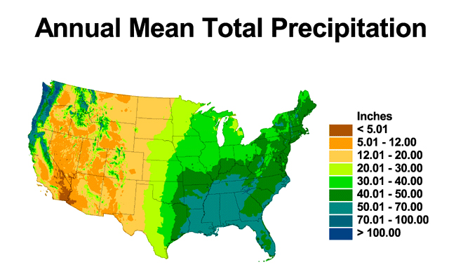
![]() Source: NOAA
Source: NOAA
In short, our water system is fractured—so split apart from its natural state that it cannot function without ever-more expensive, heavily engineered systems.
That's for now. According to the National Climate Assessment, in coming years, the
Midwest is in store for increased rainfall and flooding, while the
Southwest can expect reduced precipitation, decreased snowpack and streamflow, and increased wildfire.
One can imagine a time when the Great Lakes may be considered a national resource, vulnerable to exploitation by the thirstiest parts of the country. Such a possibility was the impetus behind the formation of The Great Lakes-St. Lawrence River Basin Water Resources Compact Council in 2008.
The compact, signed by eight Great Lakes governors, put forth a set of agreements governing use of Great Lakes water, including restrictions on water withdrawals from entities outside of the basin. So far, only one challenge to the compact has arisen; a pending
application by the City of Waukesha, Wisconsin to divert water for municipal use.
More applications are expected to follow. A long-distance pipeline of Great Lakes water across the Rocky Mountains may not seem likely now, but given future climate impacts and economic distress, that may change.
And while these states grow thirstier, water management in the Great Lakes is plagued by disconnection: surface water is disconnected from groundwater, streams and lakes are dammed and overloaded with polluted stormwater, communities struggle with high water rates, and water infrastructure—sewers, water lines, treatment facilities—are aging and in need of expensive repair. On top of all that, water systems are managed by many layers of governments and utilities.
In short, our water system is fractured—so split apart from its natural state that it cannot function without ever-more expensive, heavily engineered systems.
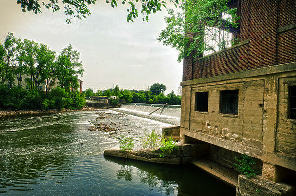
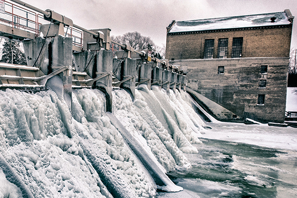
![]() Huron River at Peninsular Paper Company, Ypsilanti/Photo by Doug Coombe
Given this state of affairs and the potential threat of thirsty states who would deign to dip a straw into the Great Lakes, the Great Lakes Commission
Huron River at Peninsular Paper Company, Ypsilanti/Photo by Doug Coombe
Given this state of affairs and the potential threat of thirsty states who would deign to dip a straw into the Great Lakes, the Great Lakes Commission, a binational organization that advances and coordinates Great Lakes stewardship between the United States and Canada, is undertaking a
Greater Lakes project to help communities understand the economic impacts of better managing water resources on a more holistic basis—to restore the function of natural watersheds to the greatest extent possible.
But to get a handle on how that might work, we would do well to understand how our waterways came to be what they are in the first place.
Liquid Riches From the Ice
"It really is related to the glacial history of the region," says John Zawiskie, a glacial geology expert at the Cranbrook Institute of Science and adjunct professor at Wayne State University, about southeast Michigan's watersheds.
"About 16,000 years ago, all of southeast Michigan was just coming out from under a giant mass of glacial ice. There were two big lobes that had coalesced to cover southeast Michigan: the Saginaw lobe and the Huron lobe. As the ice started melting, the lobes began to shrink. An area between Saginaw and the Huron lobe essentially became a giant ice-walled valley. Ultimately, as the ice and lobes melted away, it left a huge area of high relief that stretches all the way from northern Oakland County down to Jackson. We call that the Interlobate Belt, an area of high elevation with thick deposits of glacial till and debris. The rivers then flowed down off these highlands, subdividing the watersheds, and creating watershed boundaries."
As a result of glaciation, southeast Michigan is drained by six major river systems, which carry water to the Saginaw Bay, the St. Clair River, Lake St. Clair, and Lake Erie.
Evidence of this glacial history is not hard to find...if you know what you are looking for.
"If you were to drive up Woodward Avenue from Detroit all the way into the central part of Oakland County, you would gently rise in elevation," says Zawiskie. "In Detroit, you start basically at the old lake floor. Periodically, some of the smaller ridges you'd be crossing over are old beach ridges from different stages that the Great Lakes went through. Once you start going past Birmingham, you're going over a series of moraines that formed along the front of the receding ice. As you continue, you get up on these even higher plateaus of sand and gravel at the headwaters of the Rouge and Clinton watersheds."
Water, Interrupted
In a natural watershed, says Zawiskie, rainfall infiltrates into the ground, where it recharges groundwater aquifers. Wetlands retain and clean water on the surface, and groundwater slowly replenishes streams and lakes. Some surface water evaporates back into the atmosphere and rain falls again, completing the circle.
But this is not what happens in the fractured watersheds of modern-day metro Detroit.
"With this huge urban sprawl, the more impervious surfaces we have—roads, parking lots, rooftops, etc.—the less infiltration happens when it rains," he says. "What this means is that, first of all, there are bigger floods, and secondly, there isn't as much infiltration to the water table. You're starting to starve the water table component to feeding local streams."
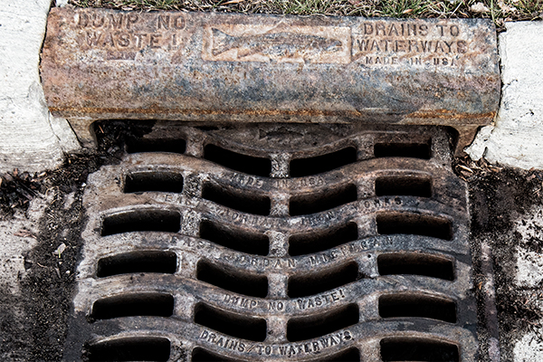
![]() Storm Drain/ Photo by Doug Coombe
Instead of a single water cycle, we are really talking about three separate cycles, according to Jeff Edstrom, a water resources scientist with ECT Inc
Storm Drain/ Photo by Doug Coombe
Instead of a single water cycle, we are really talking about three separate cycles, according to Jeff Edstrom, a water resources scientist with ECT Inc., an Ann Arbor-based environmental consulting firm. Edstrom is an investigator for GLC's Greater Lakes study.
"The first water cycle is the natural water cycle where you have precipitation trickling into groundwater or flowing directly to a stream over land," says Edstrom. "In developed areas, there is a water use cycle, which is taking water from a source—either ground or surface water through pipes, and taking it to treatment, then distribution, then use within a home or outside. Then it's collected and put into a sewer system and then transported to a treatment plant where it's treated and then discharged back into the environment."
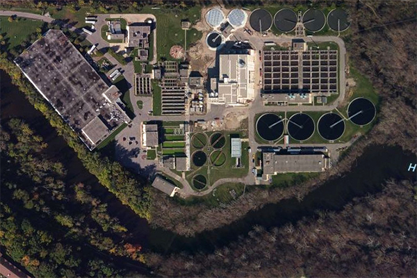
![]() Ann Arbor Wastewater Treatment Plant and the Huron River/ Photo Credit: Bing
But the third water cycle, says Edstrom, has the most impact on waterways.
"The third water cycle is the interrupted water cycle," he says. "It's rainfall and snow hitting pavement and then being pushed into a series of pipes and moved directly to a stream rather than staying where it falls and being part of a natural water cycle. It creates a number of issues; downstream flooding because you need to move that water away, and water pollution from contaminants it picks up from pavement."
Ann Arbor Wastewater Treatment Plant and the Huron River/ Photo Credit: Bing
But the third water cycle, says Edstrom, has the most impact on waterways.
"The third water cycle is the interrupted water cycle," he says. "It's rainfall and snow hitting pavement and then being pushed into a series of pipes and moved directly to a stream rather than staying where it falls and being part of a natural water cycle. It creates a number of issues; downstream flooding because you need to move that water away, and water pollution from contaminants it picks up from pavement."
William Christiansen with the
Alliance for Water Efficiency, another investigator for the GLC Greater Lakes project, evaluated the costs and benefits of water efficiency measures (the second cycle), such as low-flow appliances and irrigation control, for three municipalities in southeast Michigan and three in Ontario, using the Alliance for Water Efficiency's
Water Conservation Tracking Tool. He also looked at the costs and benefits of using green infrastructure for stormwater management (the third cycle), such as natural vegetation and swales to absorb rainfall runoff.
Edstrom points out that both water conservation and stormwater measures are needed.
"They are both important," says Edstrom. "There is a need for integrated water management—a combination of water conservation and efficiency together with green infrastructure to keep water closer to where it falls."
Reconnecting the Water Cycle in the Huron River
"We estimate we've lost about two-thirds of the wetlands that were originally in our watershed, and a lot of the natural areas and farmlands," says Laura Rubin, executive director of the Huron River Watershed Council. The Huron River runs through western Oakland and much of Washtenaw and Monroe counties. "With the increase of impervious surface, we really changed the hydrology, the temperature, and the water quality. We're trying to change that trajectory. We'd like to get it to more of a natural system."
Rubin's organization works with watershed communities on ways to reconnect the natural water cycle to the greatest extent possible. That means removing dams, working with dam operators to simulate more natural flows, and installing green infrastructure.
![]() Barton Dam/Photo by Doug Coombe
Getting communities to adopt green infrastructure as a way to manage stormwater is not easy, says Rubin.
"When the rubber hits the road, it's the engineers who have a hard time being really confident in the green infrastructure numbers," says Rubin. "They always fall back on gray infrastructure, and I always feel like they see (green infrastructure) as an extra. They're worried that they'll be sued."
Promoting water conservation is also part of the Council's work.
"Water conservation messages in the Great Lakes are hard," says Rubin. "But when we tied it more to energy and carbon footprint, it was a lot more effective." To this end, the Council recently released "The Carbon Footprint of Domestic Water Use in the Huron River Watershed
Barton Dam/Photo by Doug Coombe
Getting communities to adopt green infrastructure as a way to manage stormwater is not easy, says Rubin.
"When the rubber hits the road, it's the engineers who have a hard time being really confident in the green infrastructure numbers," says Rubin. "They always fall back on gray infrastructure, and I always feel like they see (green infrastructure) as an extra. They're worried that they'll be sued."
Promoting water conservation is also part of the Council's work.
"Water conservation messages in the Great Lakes are hard," says Rubin. "But when we tied it more to energy and carbon footprint, it was a lot more effective." To this end, the Council recently released "The Carbon Footprint of Domestic Water Use in the Huron River Watershed," which found that the carbon intensity of residential water use is nearly ten times that of drinking water and wastewater treatment combined.
Ann Arbor's water utility has implemented two mechanisms to incentivize water users to both conserve water on the use side and reduce runoff; water rates are tied to consumption and sewer rates to the amount of impervious surface, and hence runoff, on a parcel of land.
"For reference, 85 percent of our drinking water comes from the Huron River and 15 percent comes from groundwater," says Jennifer Lawson, Water Quality Manager for the City of Ann Arbor. "So there really is that integration of stormwater and drinking water systems."

![]()
This piece is made possible through a partnership with the Great Lakes Commission through the Greater Lakes project. This piece is the first in a series. Our next piece will go more in-depth about solutions for integrated water management.
Graphic at top provided courtesy of the Great Lakes Commission.
Enjoy this story?
Sign up for free solutions-based reporting in your inbox each week.