The warm(-ish) weather has finally returned to metro Detroit, and for many that means it’s time to hop on a bike, strap on some rollerblades or just put on plain old sneakers to hit one of the region’s numerous non-motorized trails.
This season brings a host of new improvements to area trails, from fresh signage and amenities to entirely new sections of trail. And it’ll also bring some convenient, brand-new tools to visualize local trails before you even leave the house.
The Southeast Michigan Council of Governments (SEMCOG) is currently prepping a comprehensive interactive online map of all the 1,000-plus miles of trails in its seven-county service area (see a preview below). Trails in Livingston, Macomb, Monroe, Oakland, St. Clair, Washtenaw and Wayne counties will all appear on the map, with a tool for users to provide feedback from the field on new, closed or altered trails. SEMCOG manager of plan implementation Kevin Vettraino says the map will be an internal resource for SEMCOG, as well as a public tool.
Here's a preview of SEMCOG's regional trail map. Hover or click on the green lines to view trail names, and search for your city to see trails close to you.
Source: Southeast Michigan Council of Governments
“We wanted to put something out there that, when we’re talking to communities or we’re writing a blog on trails, that we can reference,” Vettraino says. “I hope that it can be more than just a map that has all the trails in our seven counties.”
Beyond that new area-wide reference, other trail improvements abound for summer 2016. Take a look at our breakdown of new ways to get your outdoor adventure on, county by county:
Macomb County
Macomb County is developing a go-to trails reference of its own. Through the Mobilize Macomb initiative, the county aims to debut both a county-led strategic planning document and a public resource by mid-summer.
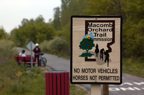
![]() Macomb Orchard Trail. Photo courtesy Community Foundation of Southeast Michigan. “When you think of Macomb County, you wouldn’t think that we have over 155 miles of trails integrated throughout the entire county,” says county planning and economic development director John Paul Rea. “What we’re trying to do is not only catalog each one of these trails but also provide connectivity to other parks and recreation assets.”
Looking ahead to future projects, Rea says the county particularly hopes to better connect trails to the county’s freshwater assets. He envisions a trail connection going up Jefferson Avenue, partnering with both Lake St. Clair Metropark and Selfridge Air National Guard Base to link trail users to sites along Lake St. Clair.
As far as physical trail improvements in the present, Rea points to the new trail spur connecting downtown Utica to River Bends Park. The 1.25-mile connector trail is the result of a partnership between the governments of Utica and Shelby Township and fills a significant gap in the county’s section of the Iron Belle Trail
Macomb Orchard Trail. Photo courtesy Community Foundation of Southeast Michigan. “When you think of Macomb County, you wouldn’t think that we have over 155 miles of trails integrated throughout the entire county,” says county planning and economic development director John Paul Rea. “What we’re trying to do is not only catalog each one of these trails but also provide connectivity to other parks and recreation assets.”
Looking ahead to future projects, Rea says the county particularly hopes to better connect trails to the county’s freshwater assets. He envisions a trail connection going up Jefferson Avenue, partnering with both Lake St. Clair Metropark and Selfridge Air National Guard Base to link trail users to sites along Lake St. Clair.
As far as physical trail improvements in the present, Rea points to the new trail spur connecting downtown Utica to River Bends Park. The 1.25-mile connector trail is the result of a partnership between the governments of Utica and Shelby Township and fills a significant gap in the county’s section of the Iron Belle Trail, the State of Michigan's mammoth planned route connecting Belle Isle to Ironwood in the Upper Peninsula. The spur also ties the Iron Belle into the major junction of the Clinton River and Macomb Orchard trails at the intersection of 24 Mile Road and Dequindre.
Kristen Bennett, Michigan Department of Natural Resources’ coordinator for the Iron Belle Trail, says that’s just one example of how communities across the state have taken action to make the 791-mile hiking route a reality since the plan was first announced in 2013.
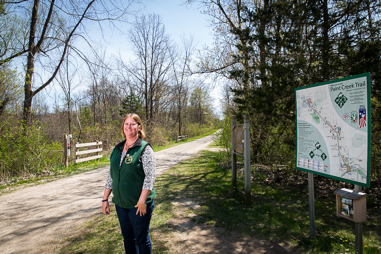
![]() Kristen Bennett at the Paint Creek Trail. Photo by David Lewinski.
Kristen Bennett at the Paint Creek Trail. Photo by David Lewinski.
“We were working with them on how you initiate this kind of thing and how you get your route planning done,” Bennett says. “Now we’re entering into more of the design phase. We know where we want to go, and we think we know how much it’s going to cost, so how do we get grants on a larger scale to make this development happen on the ground?”
Oakland County
Iron Belle Trail development is also underway in Oakland County, where Orion Township and the Polly Ann Trail Council respectively received $25,000 and $15,000 this year from the
Michigan Department of Transportation’s Transportation Alternatives Program (TAP) to develop sections of the Polly Ann Trail.
Trailgoers will also see major improvements this summer on the Clinton River Trail, which runs 12 miles from Pontiac, almost the middle of the county, to its eastern edge in Rochester where it connects to the Macomb Orchard Trail at Dequindre. By June construction will be complete on new trailhead kiosks, informational signage at each major road-trail intersection, interpretive signage and two new picnic shelters. The TAP-funded project was spearheaded by the nonprofit Friends of the Clinton River Trail.
“It was really a branding project to create a unified look for the trail,” says Oakland County senior planner Kristen Wiltfang. “It passes through five communities. They wanted to have that unique look to all of the signage and branding materials along the trail.”
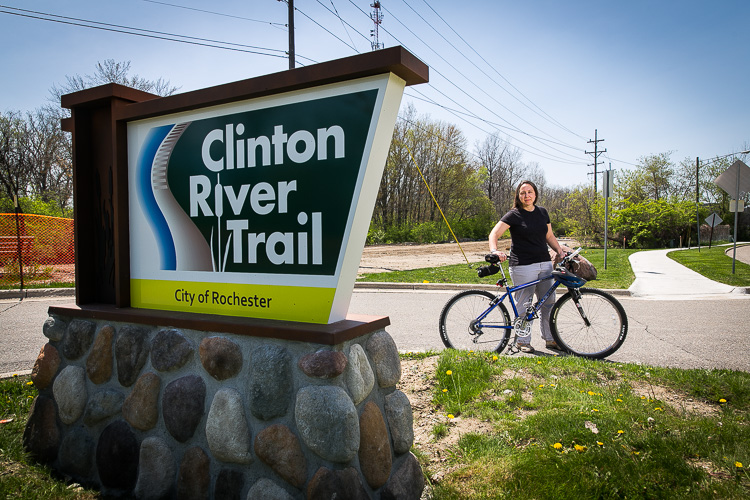
![]() Kristen Wiltfang at the Clinton River Trail. Photo by David Lewinski.
Kristen Wiltfang at the Clinton River Trail. Photo by David Lewinski.
In upcoming projects, Wiltfang notes that the county is working with the communities of Wixom, Walled Lake and Commerce Township to finalize the purchase of a 5.5-mile stretch of the former Michigan Air-Line Railroad. The unused railway would be remade into the "Michigan Air-Line Trail" over the course of the next two to three years. The prospective route would bridge the Huron Valley Trail,
M-5 Metro Trail and the
West Bloomfield Trail, while also filling what Wiltfang describes as a “key gap” in the larger
Great Lake-to-Lake Trail linking Port Huron to South Haven.
Wayne County
The Iron Belle Trail will also make some headway in Wayne County this summer, with a new 0.75-mile greenway trail along Jefferson Avenue adding another piece to the Iron Belle puzzle. More importantly in the short term, the greenway will now link Trenton’s Elizabeth Park to the Detroit International Wildlife Refuge Gateway. The project is part of the Downriver Linked Greenways Initiative, which aims to create a connected trail network throughout the Downriver area.
Elsewhere in the county, cyclists and pedestrians will now find an easier and safer route from Maybury State Park to Hines Park. “The Link,” a 3.5-mile network of marked bike lanes and pedestrian paths, is a collaboration between Northville, Northville Township, Novi, Maybury State Park and Wayne County Parks. Mountain bikers will also find three miles of new trails at
Hines Park, the result of collaboration between Wayne County Parks and the Motor City Mountain Biking Association.

![]() Todd Scott at the Dequindre Cut. Photo by David Lewinski.
Todd Scott at the Dequindre Cut. Photo by David Lewinski.
The city of Detroit will also see significant non-motorized developments this summer. Bike lanes will run south from Midtown along Cass Avenue, and then jog east a bit to reach Cobo Center. The city is also set to create four miles of protected bike lanes this summer along Livernois from Grand River Avenue to West Vernor. Detroit Greenways Coalition executive director Todd Scott notes that other protected bike lane projects are under discussion, including along Jefferson Avenue.
Most notably for Detroit, this month saw the official opening of a 0.5-mile extension of the Dequindre Cut that expands the bike and pedestrian trail into Eastern Market. Scott says the expansion helps address what was previously “the biggest negative” to the oft-noted trail: it wasn’t very long.
“It becomes a much bigger destination than it was before, when you could park in a dirt parking lot at Gratiot and ride it a short distance,” Scott says. “As it connects more and more of these trails together, it becomes more and more of a regional draw because it’s worth the travel to get there and check it out.”
Scott is referring to the proposed Detroit Inner Circle Greenway; a 26-mile non-motorized loop would link the Dequindre Cut, the Detroit RiverWalk and other existing paths with trails yet to be constructed. One element includes the proposed rehabilitation of an eight-mile stretch of the former Detroit Terminal Railroad. Earlier this month the city submitted a U.S. Department of Transportation Investment Generating Economic Recovery (TIGER) grant request to convert 5.5 miles of the railroad to trail.
“It’s going to serve as the spine or the backbone for all the non-motorized trails throughout the city,” Scott says. “The historical significance of the sights along the way, the automotive heritage, the unique local business districts it connects, the jobs–it really is an exciting non-motorized trail project that’s about much more than a place for people to ride their bikes or walk.”
Enjoy this story?
Sign up for free solutions-based reporting in your inbox each week.