It’s drizzling as Ryan Crenshaw pulls his trailer into the parking lot along the Clinton River across from Yates Cider Mill. But Crenshaw is unintimidated by a bit of wet weather. He’s planning to ride a contraption of a boat downstream today, carrying an unusual bit of cargo: A 360-degree camera.
Crenshaw’s Richmond, Virginia-based firm, Terrain360, will create comprehensive 360-degree visual maps of southeast Michigan’s land and water trails--think Google Street View for nature--for anyone who’d like to explore from the comfort of their handheld device or personal computer. Water trails are photographed via a custom-built boat, while land trails are photographer via custom-built tricycle.
The company has completed similar projects in the Chesapeake Bay area, with the goal of bringing people closer to the resources that are around them.
“You can access the images and get an idea of where you want to go before you ever leave home,” says Crenshaw. “You can show this to kids and get them excited about the watershed and the different trails in the area. And it just promotes more access and more people getting to know their resources here a lot better.”
The goal of the effort is to highlight the region’s trails network for both residents and visitors.
![]()
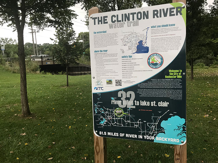
“The region’s water trails and access to fresh water are major attractions for tourism, as well as reasons why families choose to call Southeast Michigan home,’ says Kevin Vettraino, plan implementation manager for the Southeast Michigan Council of Governments (SEMCOG), who is spearheading the effort. “Whether it’s along the Detroit River, Lake St Clair, or one of the hundreds of inland lakes, rivers, and streams, the region boasts some of the state’s most scenic and popular hiking and biking trails.”
Macomb County Land and Water Resources Group Program Manager Gerry Santoro is excited for the potential of the tool to serve as a trip planning tool for local adventurers.
“This project creates the capability for people to plan and see what their natural resources have to offer,” he says. "They can assess the river and make some decisions about what parts of the river they want to explore.”
The following trail segments are scheduled to be documented as part of the effort:
Hiking and biking trails
Livingston County: 20 miles of Lakelands State Park Trail
Macomb County: 36 miles, including Macomb Orchard Trail, Clinton River Park Trail, and River Bends Park Trail
Monroe County: 14 miles, including River Raisin Heritage Trail, National Battlefield Park, and Sterling State Park Trails
Oakland County: 55 miles, including Addison Oaks County Park and the Clinton River, Paint Creek, Polly Ann, and West Bloomfield Trails
St. Clair County: 14 miles, including Blue Water River Walk in Port Huron and Wadhams to Avoca Trail
Washtenaw County: 25 miles of Border-to-Border Trail
Wayne County: 44 miles, including Detroit Riverwalk and Dequindre Cut, Downriver Linked Greenways, and Hines Park Trail
Water Trails
Livingston/Oakland/Washtenaw/Wayne Counties: 140 miles of Huron River Water Trail
Macomb County: 70 miles, including Clinton River Water Trail and Lake St. Clair Water Trail
Monroe County: 44 miles of River Raisin Water Trail
Oakland County: 41 miles of Clinton River Water Trail
St. Clair County: 116 miles of Blueways of St. Clair
Wayne County: 62 miles, including Detroit River Heritage Trail and Rouge River Water Trail
The 360-degree visual maps will be integrated into the Southeast Michigan ParkFinder.
Enjoy this story?
Sign up for free solutions-based reporting in your inbox each week.