Back in Detroit's post-World War II era, community leaders had many grand ideas that transformed the face of Metro Detroit. One of the grandest was the creation of a major beach attraction out of marshland south of the Clinton River.
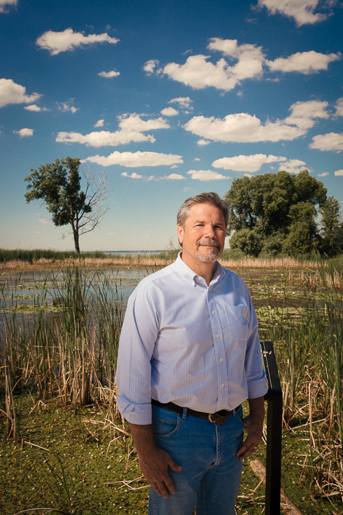
"If you go back before the Metropark was here, there was a large wetland here," explains Paul Muelle, Chief of Natural Resources for the Huron-Clinton Metropolitan Authority. "Folks back then had big ideas and big dreams and big projects. This park was one of them."
In the late 1940s, hundreds of acres of marshland were dredged and filled to create the sprawling beach complex at Metropolitan Beach. A massive recreation center with paved walkways and huge parking lots greeted generations of families from all over the region who flocked there for swimming, boating, and picnicking starting in 1950.
Known today as Lake St. Clair Metropark, the 770-acre tract is a part of the Huron-Clinton Metropark system that serves the region. Over the past several decades, the beach on Lake St. Clair has been notorious for ongoing closures related to high levels of E. coli bacteria. At times, the shoreline has been overrun with a film of green algae. This year, Metro Beach has been closed for swimming only one day, on July 7. However, Memorial Beach has been closed since July 19.
Data provided by Macomb County Health Department
The Clinton River and other local tributaries such as the Salt River flow directly into the lake. The watersheds of these waterways feature significant residential, commercial and industrial development. Vast areas of impervious surface and aging and undersized infrastructure result in intermittent sewage overflows and heavy stormwater runoff, which often impair water quality in the nearshore areas of the lake.
To compound the problem, virtually all of Lake St. Clair's natural shoreline wetlands have been removed and replaced with rock and metal barriers, preventing the natural flow of stormwater through cleansing wetlands along the water’s edge.
Although researchers have been studying the effects of development on the area’s water for years, water quality problems continue to plague the lake. Despite these challenges, the lake still continues to support a billion-dollar recreational boating and fishing industry while providing significant habitat for local wildlife.
Lake St. Clair provides habitat for 70 species of fish, 48 of them dependent on remnant marshlands and shallow areas of the lake, 38 species of reptiles and amphibians, and 90 species of birds, according to Bill Parkus, who manages the Lake St. Clair/St. Clair River Protection and Restoration Partnership for the Southeast Michigan Council of Governments. “This high biodiversity is the driver behind Lake St. Clair’s internationally acclaimed sport fishery. Fishing and boating activities along the Huron to Erie Corridor pumps approximately $1.7 billion annually into Southeast Michigan’s economy.”
Greening the landscape to support a "blue economy"
For several years, Macomb County has promoted its "Blue Economy" initiative, designed to leverage the economic opportunity presented by the county's proximity to water resources.
This year, the county has gone inland with the
Green Macomb initiative, an effort to reforest a portion of the Clinton River watershed in 12 southern Macomb County communities. The absence of tree canopy and wetlands in older, fully developed places like Warren, Roseville, and Fraser reduces their ability to absorb and clean stormwater. The result is a heavy impact on local infrastructure, the Clinton River and ultimately Lake St. Clair.
The overall goal is to increase tree canopy coverage in the area to 40 percent of the land area in Macomb County. The city of Centerline currently has a tree canopy of just 10 percent; Shelby Township, one of the counties less intensively developed suburbs, has a tree canopy of 32 percent, according to Gerard Santoro, program manager of the Macomb County Land and Water Resource Group.
"We’ve recognized that we severely lack in tree canopy," Santoro says. He says the county not only needs to replenish trees, but also needs to find "the right trees in the right place for the right purpose." It’s less about aesthetics and more about functionality.
"You have 1.5 million people living in a densely populated watershed in the south end of Macomb County," says Santoro. "All of this water drains into Lake St. Clair. It is a very important part of the Macomb County story."
Softening the shoreline
Another part of that story is 29 miles of hardened shoreline, including several miles of residential canals, which minimizes the natural process of water absorption and flow into the lake.
![]()
But over the past several years, Lake St. Clair Metropark has undergone a transformation, re-engineering and reconnecting the Black Creek Marsh with the Clinton River to the north and the Point Rosa Marsh with the lake to the south. Muelle has overseen work on restoring the marshes, which included a redesign of the park's massive parking lot.
Originally, stormwater runoff from the parking lot was collected in catch basins and storm pipes and discharged directly into the Black Creek, which outlets into Lake St. Clair along the park's northern border. A hydrology study found that the marshes needed more water to be healthy. So several wetlands and green infiltration islands have been created within and around the parking lot to redirect storm water to the Point Rosa Marsh on the west side of the park. Not only does this restore the marshes, but it also reduces the amount of unfiltered runoff going into the lake.
"Marsh systems are a mechanism for helping us clean water. We’re using that for our parking lot and the park in general," says Muelle. "Now when it rains, the stormwater is still collected in the catch basins and pipes, but it outlets into the ditches and flows into new vegetative swales and wetlands that were created where there once was a parking lot. Eventually, it flows into the marsh, helping to improve the ecosystem."
The revived ecology is already revealing benefits. Muelle says several wildlife species determined "threatened" or of "special concern" have been observed recently in the wetlands, such as marsh wren, least bittern, Blanding’s turtle, spotted turtle, common moorhen, black-crowned night heron, eastern fox snake, and Forster’s tern.
Studying the problem
“There’s no question that the Lake St. Clair basin is hugely important to the ecological health of Lake St. Clair and the Huron to Erie interconnected waterways,” says Dr. Carol Miller, professor of Civil and Environmental Engineering at Wayne State University, and director of the Wayne State's
Healthy Urban Waters Initiative. Dr. Miller also leads the
Huron to Erie Alliance for Research and Training (HEART) research team, with a field station at Lake St. Clair Metropark.
They are evaluating many connections between the ponds, marshes, and rivers on park land with the groundwater beneath the park and Lake St. Clair.
In June, Dr. Miller initiated a study to examine groundwater movement paths in the near-shore areas to better quantify the water balance affecting Lake St. Clair.
“How much of the total water addition to Lake St. Clair actually comes from ground water or surface water or pipes with storm water discharge?" asks Miller. "How important is the natural groundwater flux to Lake St. Clair, not only in terms of quantity, but also in terms of quality. Of the various pollutants we might see in Lake St. Clair, what percentage arrives through ground water pathway?”
Recent surface water improvements at the park, such as the “greening” of the parking lot area, should have positive impact on water quality in the lake, she adds. These improvements provide for greater use of natural filtration processes before the storm waters discharge to Lake St. Clair. “Before it was dumped quickly overland,” Dr. Miller says. “There was little filtration. The first bit that would come could be highly polluted. Now we can delay that process. It should create an even cleaner environment.”
Dr. Miller works alongside other research colleagues to study other topics such as “beach muck”, invasive species like phragmites, and methods of communicating environmental information to the public.
![]()
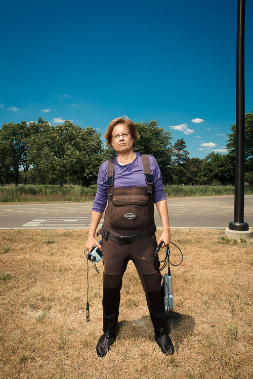
Researchers are testing a new method of gauging beach water quality that can provide results much more quickly than the current turn-around time of 24 hours. The beach testing is headed by Dr. David Szlag of Oakland University.
A forever-altered natural resource
Lake St. Clair will likely never be restored to a pristine condition. But Santoro says the convergence of government, environmental, business and academic interests have created a new dynamic that serves as a model for how natural assets in urban industrialized areas can thrive economically.
Today, the restored Black Creek and Point Rosa marshes resemble wetlands that once existed at the mouth of the Clinton River. A boardwalk extending about one-fifth of a mile into the marsh is enough to transport a visitor from the parking lot into an area of still water where you might see a muskrat come up with a fish, or a turtle sitting idle next to a duck, or rabbits, or even a deer in the brush.
The presence of these and other animals, fish, and reptiles are hopeful signs of renewal.
But perhaps the most compelling view of what’s at stake is at the Point Rosa Marsh overlook. From behind, you hear the sound of the beach and motor craft on the water. Immediately nearby you hear frogs in the marsh. Looking west, you see the natural shoreline with a ring of green film leading to the metal retaining wall protecting residential development.
An interpretive panel at the marsh reminds us that this restoration will provide ecological and educational value, even if the environment continues to face challenges into the future,
Masthead photo by David Lewinski.
Enjoy this story?
Sign up for free solutions-based reporting in your inbox each week.